Re: Google Navigation Challenge 2. Prudhoe Bay - Ushuaia
Posted: 21 Apr 2015, 16:57
Thomas De Bock wrote:Prudhoe Bay - Ushuaia Challenge - day 11: La Mancha to Paso Hondo
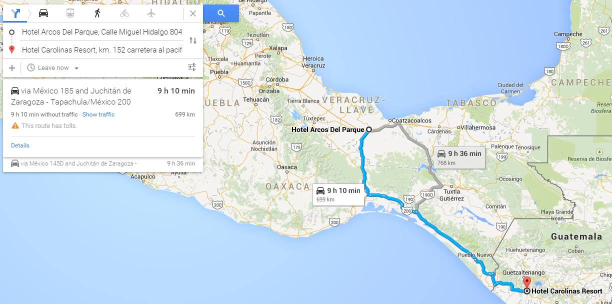
After the oddly relaxing sleep in a bamboo hut, we got up early for our dash towards Guatemala. We could reach Guatemala within ten hours, but not any hotel, and any Northern route would either cut it too short or be stifled by the intensely annoying Chixoy River. To top it off, the organisers were still very annoying with their regulations. When we drove back towards the highway, we couldn't cross directly and turn left. No. We had to turn right and go the opposite way. We came across another intersection where we weren't allowed to U-turn, as clearly said by the "NO U-TURN" sign featuring the race's logo. We turned off, headed down the road and looped around the first block we could find before heading back towards the highway where, for some unknown reason, we were allowed to turn left...
We continued South towards the resort city of Veracruz, passing through Ursulo Galvan and José Cardel. For some reason, the Mexicans don't only name their towns with the surnames of their heroes, but their forenames as well. We didn't remember passing through George Washington, Montana... Either way, we never actually reached Veracruz. We turned South a bit before it, towards the Pacific Ocean. This route was slightly longer on sheer length, but considering our allowance of 10 hours, would hopefully get us to Colon in first place.
We didn't completely cross the isthmus, though, but we certainly left the coastline...for a while. Soon enough, we were nearing the Gulf again, with Coatzacoalcos, a city which, for an unexplainable reason, sounded like those Flemish girls might want to stay there. We hadn't seen them since Deadhorse. In fact, we hadn't seen anyone since Tok, aside from the Voecklers. Truth be told, we're hoping to not be a day ahead of everyone come Colon, to have some company on the ferry to Cartagena...
This was the day's halfway mark, and we definitively turned South towards Tuxtla Gutiérrez. We crossed a bridge over a lake that I won't even try to spell, much less pronounce, before reaching the city that featured the start of almost all Carrera Panamericana races. We'd essentially done it backwards, and starting from a bit further up North... But the day didn't end there. We continued due South East towards the border with Guatemala. We hoped to reach the border town of Ciudad Cuauhtémoc, but it was soon apparent we'd have to bail. We took the last possible escape route, Paso Hondo, and stopped at the brilliantly named Hotel "RIVER". Oh, the anticipation...
http://www.formularejects.com/uploader/ ... /leg11.png
Staying at HOTEL "RIVER", 1° Avenida Sur Ote, Paso Hondo, Municipio de Frontera Comalapa, Chiapas, Mexico
Route details: Just off Highway 180, km 31, La Mancha-Actopan - 1° Avenida Sur Ote, Paso Hondo.
4 days 10 hours 18 minutes total driving time
9726 kilometres total distance
